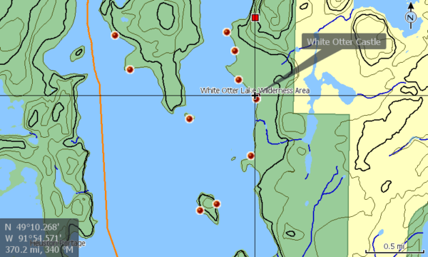
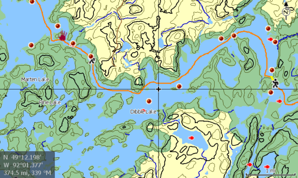
This is a Bonus map that covers the area in and around the Turtle River White Otter Provincial Park. The map can be combined with our Quetico Boundary Waters Fishing Enthusiast Map or can be installed on separately.
The Campsite and Portage information contained in this map should be used with caution as I did my best to manually place them, their accuracy is not guaranteed. They should be used as a general reference as to locations.
Lowrance format, AT-5 Map, compatible with most Lowrance Fish Finder Combo units manufactured in the last 10 years. (Elite HDI, Elite Chirp, Elite Ti, Elite Ti2, HDS, Hook, Hook 2, Hook Reveal, or 2024-Eagle).
This Free vector based map consists of the following features for Turtle River White Otter Provincial Park:
-
-
- Accurate Lake shape outlines with islands, rivers, streams and emergent rocks shown.
- Campsite and Portage information. 2
- Land contours ( 10M= Quetico, 30 Ft =BWCAW).
- Fish Species data for most lakes.
- Provincial Park boundaries.
- Select Roads and trails displayed.
- Lake and area names for quick reference.
- Entry Points and outfitter locations.
- Wide area reference points/features for orientation and navigation to the area of focus.
- All Data embedded into map layers, No waypoints used. Save your waypoints for marking your fish, discoveries or observations.
-
-
-
- Not affiliated with Lowrance or CMAP Genesis.
- Source: Ignace Turtle River Map and Path of the Paddle Maukinak Section digital map downloads.
- Contains information licensed under the Open Government License – Ontario, Ontario Ministry of Natural Resources and the Queen’s Printer.
- Contains data compiled from contributions made by the MNDNR, U.S. Geological Survey, MDNR Division of Fish & Wildlife – Fisheries Unit, National Interagency Fire Center & National Oceanic and Atmospheric Administration.
- No Warranty. The Free software included in this product is distributed in the hope that it will be useful, but WITHOUT ANY LIABILITY OF OR ANY WARRANTY from Custom Advantage Gear, LLC. Do not rely on this product as your primary source of navigation. Data may be incorrect or missing, or conditions may have changed, as often happens in beaver habitat. Always be aware of your surroundings and use good judgment. Water levels are often different between lakes, and moving water could be dangerous. Locate and use the portages whenever possible. User assumes all liability for operation and associated risks.
-


Clustering –
This map seems incredibly useful for anyone planning a fishing trip around Turtle River White Otter Provincial Park. The compatibility with various Lowrance Fish Finder units makes it accessible for a wide range of users. However, it’s important to note that the campsite and portage information might not be entirely accurate. It’s great that it’s a bonus map and can be combined with other maps for a more comprehensive guide. Have you personally used this map for navigation in the park?